Solution summary
Suggest editsThe Esri ArcGIS solutions provide customers with industry-specific configurations for ArcGIS that were designed to meet key business requirements and support common workflows in an organization. Esri clients interact with geodatabases that include a collection of tables, views, and functions. The geodatabase schema can be stored in flat files or database systems. Esri ArcGIS Pro is a professional desktop GIS application that you can explore, visualize, and analyze GIS data with. You can also create 2D maps and 3D scenes and share your work to an Esri ArcGIS online or Esri ArcGIS Enterprise portal.
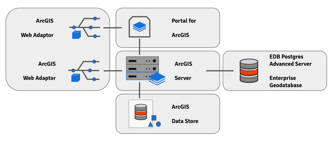
Esri ArcGIS can connect with EDB Postgres Advanced Server and PostgreSQL databases in different modes to create an enterprise geodatabase. The enterprise geodatabase consists of a multi-tier architecture that implements advanced logic and behavior in the application tier. An example is the Esri ArcGIS software on top of a data storage tier (RDBMS software) or, in our case, EDB Postgres Advanced Server or PostgreSQL. The geographic data is then managed between both the ArcGIS software and the RDBMS. The pieces of an enterprise geodatabase define how data is stored, accessed, and managed by ArcGIS.

Could this page be better? Report a problem or suggest an addition!